The River
The Black River is one of the defining features of St. Elizabeth. For generations it served as a transportation route through a landscape of marshes, tributaries and dense vegetation, carrying people and goods toward the town and the sea.
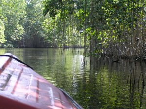
From the interior to the sea
Once thought to be the longest river in Jamaica, the Black River measures about 53.4 kilometres (33 miles) and is navigable for roughly 40 kilometres (25 miles). It is supported by tributaries that include the Y.S., Broad, Grass and Horse Savannah rivers.
Historically, the river was one of the parish's main transportation routes. Water offered a practical way through areas where dense mangrove swamps and wetlands made overland travel difficult, helping connect inland districts with Black River town and the coast.
The river gets its name from the darkness of the riverbed, where decomposing vegetation has accumulated over time and gives the water a dark appearance, especially in heavily vegetated areas.
Upper reaches and the Upper Morass
The river begins inland and emerges north of Siloah near the southern edge of the Cockpit Country. At Maggotty it runs close to the road, where small waterfalls, dense vegetation and the Black River Gorge form a very different landscape from the slow-moving lower river.
South of Maggotty, beyond Newton, the river enters the Upper Morass, where it is joined by the Smith River and smaller tributaries. Thick rushes dominate sections of this landscape, while nearby agricultural activity has also affected water quality through runoff.
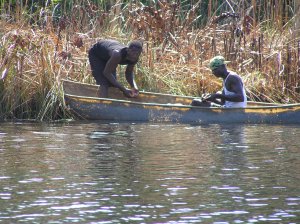
Fishing and life along the river
The river and wetlands have long supported fishing and small-scale livelihoods. In the Elim area, fish farming has also been used as a way to supplement food production and reduce pressure on coastal fisheries.
Birdlife is equally visible. The northern jacana, sometimes called the “Jesus bird” because it appears to walk across floating vegetation, is one of the species associated with the wetlands.
Through the Lower Morass
After passing through Lacovia, the river enters the Lower Morass before reaching the sea at Black River, the parish capital. In this lower stretch, the river merges with tributaries including the YS River near Middle Quarters.
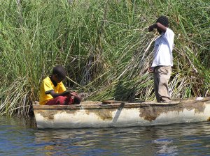
A working waterway
Fishing remains part of the river landscape. Around Middle Quarters and the Lower Morass, local fishers have traditionally used baskets and traps to catch freshwater and brackish-water species.
The river today carries a different kind of traffic as well, with guided tours bringing visitors into the mangroves and wetlands that now form one of the region's best-known natural landscapes.